With two days of sunshine forecast I packed my bags and set of for North Cornwall early. Well OK, about 11. After about an hours drive I realised I’d gone the wrong way, not seriously wrong, but a bit wrong so it was time for an impromptu drive across Bodmin Moor. That’s never a problem in my books as Bodmin Moor is one of my favourite spots, appeals to my misanthropic tendencies for a start! Before I knew it I was in the relative civilisation of Blisland, with its village green and well regarded pub. A few miles further and I was in St Tudy.
 |
| Lost? Confused? Looking for the toilet?! |
Trebarwith Strand
Still not exactly where I wanted to be I headed for the coast. I’d never really thought about this but there aren't actually that many accessible beaches along this stretch of coast so I went for the nearest, the ever popular Trebarwith Strand. It’s about 20 years since I was last down here and nothing has changed - I made that bit up as I can’t remember anything about the place except they sell beer in the pub overlooking the beach, the Port William!The beach itself is a mix of rocks and sand with a gert big rock off the coast. For those of you familiar with big rocks just of the coast you’d be right in guessing it’s called Gull Rock. The approach to the beach is very interesting, consisting of a big groove / walkway apparently cut into the slate.
 |
| Trebarwith Strand. Cornwall's dog friendliest beach? |
The Strangles and High Cliff
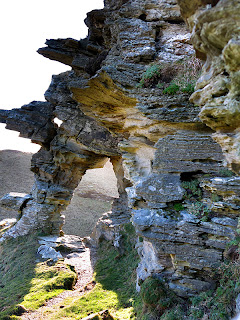
After spending more time and energy that I should have at Trebarwith I headed to the most northerly destination I had planned, The Strangles beach. This was just a name on a map to me so I had no idea what to expect. After a 20 minute drive and increasingly narrow lanes I ended up in a small National Trust car park opposite the footpath down to the beach. Ten minutes later I was looking down on the Strangles. There were only a couple of people on the beach and it’s easy to see why as the scramble down to the beach is hard work and quite a way from the road. The beach is backed by high cliffs with interesting rock formations (Crackington Formation?) and scree sloping down to the beach. The beach itself is sand and shingle with a distinctive rock stack in the middle and a rock arch at the northern end. |
| The Strangles from High Cliff |
From here, I figured as I was close I’d nip down the coast to the imaginatively named High Cliff, which is, yes, the highest cliff in Cornwall at 223 metres (732 ft) straight down. It’s only about a mile along the coast path, but as we are in Cornwall the path dips down practically to sea level on the way so it was about has hard going as it sounds.
As I always find when I climb to the top of things (which I always do) the view was fine, but not really any better than 500 feet lower down. Still, that’s ticked off the list and I've got the photos and aching legs to prove it.
Rocky Valley
 |
| Rocky Valley |
 |
| Ladies Window |
Back to Tintagel
I was now becoming acutely aware that the sun was setting and I didn't want to taking pictures in a wooded valley at sunset! At this point my legs wanted to go home but all that cycling around West Cornwall has taught me to grit my teeth and get on with it. So with minutes until sunset I jumped in the car and drove the couple of miles to Tintagel, parked up and headed for the cliffs.Well, as so often happens there wasn't really a sunset - it was more a case of the sun apologetically shuffling off to bed! So there I was, camera in hand on the end of Barras Nose with no sunset. I did take a couple of photos looking up the coast and I’ll see if I can turn up the sunset with Photoshop, but not too hopeful.
On my return to the car I did get a shot I'm quite happy with of the Camelot Castle Hotel (designed by Silvanus Trevail if I'm not mistaken), so not a complete waste of time.
 |
| Camelot Court Hotel, Tintagel |
I was actually quite relieved when the sun disappeared as it meant I was heading 5 miles inland to my B&B in Camelford, ready for another full day’s photographing starting with Roughtor, the second highest point in all Cornwall!


1 comments:
Pretty sure we were down on The Strangles when you were up on the cliffs. Beautiful place.
Post a Comment